You have most probably heard about Seoul’s famous mountain, Bukhansan. Situated in the northern park of the city (Dobongsan station- line 7), It has been designated as a national park since 1983. The meaning behind the name is literally “big mountain in the north”. The mountain has multiple sharp peaks that contrast with the forest and rivers flowing below.
For those who are not aware, there is a kakao group chat for Hanyang exchange students called “Hiking lovers”. It is an open chat and open to Hanyang students but we mostly use English to communicate. Through this chat we organized a group hike in the Bukhansan Park and brought friends. We were around 20 people, which is definitely a large group that didn’t go unnoticed. Fact: lot of older people hike in South Korea and they will definitely look at you if you’re a foreigner – or even ask to take a picture with you like it happened to us. Also, people really come prepared for hiking as they have walking sticks, the hiking shoes, backpack, sports clothes and something to cover their faces from the sun. In all honesty, the sticks are a pretty good idea if you are a novice hiker or decide to go hiking in pretty steep slopes.

The trail we decided was in Dobongsan mountain- Sinseongdae course. This course leads you to the 3 highest peaks of the mountain: Seoningbong Peak (709m), Manjangbong peak (718m) Jaunbong peak (740m). We started with another trail that I do not remember and found ourselves at Obong peak I believe after 3km. The path is almost 45 degrees up and is made mostly of rocks or metal stairs. There were times I was struggling so I do recommend or advise to maybe go for a shorter one or easier trail before. After that we decided we wanted to continue hiking, which not everybody was up to and so our group split up.
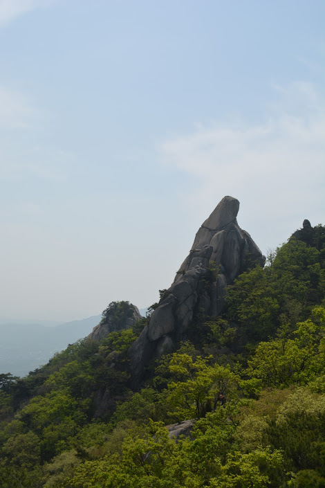 We took the route to Jaunbong peak which was around 2.4km from where we where. Around Jaunbong peak where lot of sharp rocks peaks that you could climb although it was pretty dangerous so please be careful! A lot of my friends slipped during the hike so hiking shoes are a plus too.
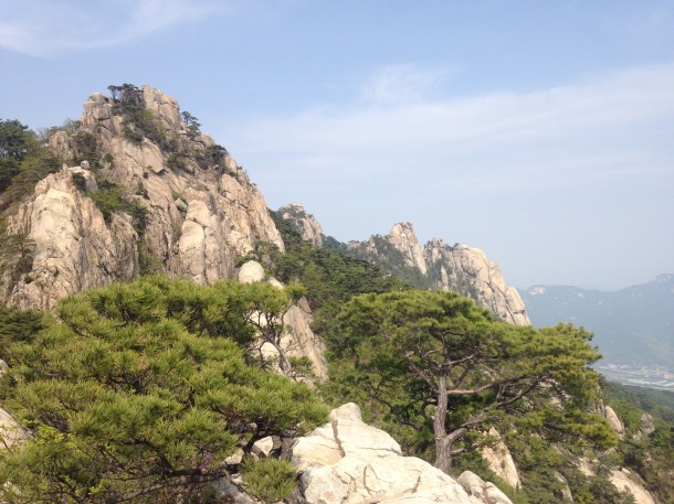 At the peak, the view is pretty amazing. On a clear day you can see pretty far although it was a bit hazy because of the bad air-conditions that happen in April. Even with those conditions, the sky was clear and it was awesome. Coming back down was a 3.5km trail to the Information Center and Ranger center. Coming back down was actually harder personally that climbing up because the rocks and leaves made it so slippery. Rocks would also be shaky and you could basically fall down easily. Because it was also a pretty steep slope it was hard on the knees. Actually 2 people from our groups fell down and grazed their legs pretty bad. Little advice- come with a small emergency kit in case that happens to you. After 2 km the trail was on a flatter ground and from then on it was like a piece of cake. Overall, we spent the day there so have in mind that it could take the whole day.
 Preparations should include a lot of water, at least 2L and lots of snacks. Even gloves would be nice because there is a lot of rock climbing and you can hurt or dirty your hands a lot.

Leave a comment